

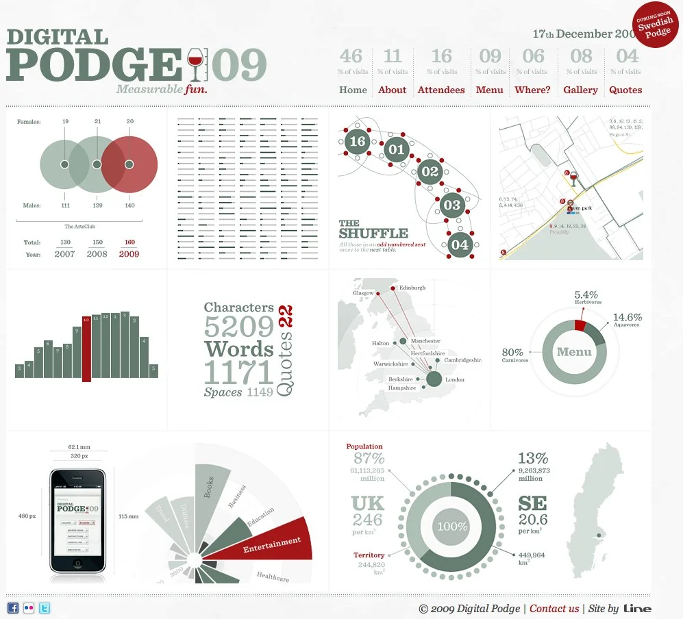
Digital Podge 09 - Fantastic infographic website design
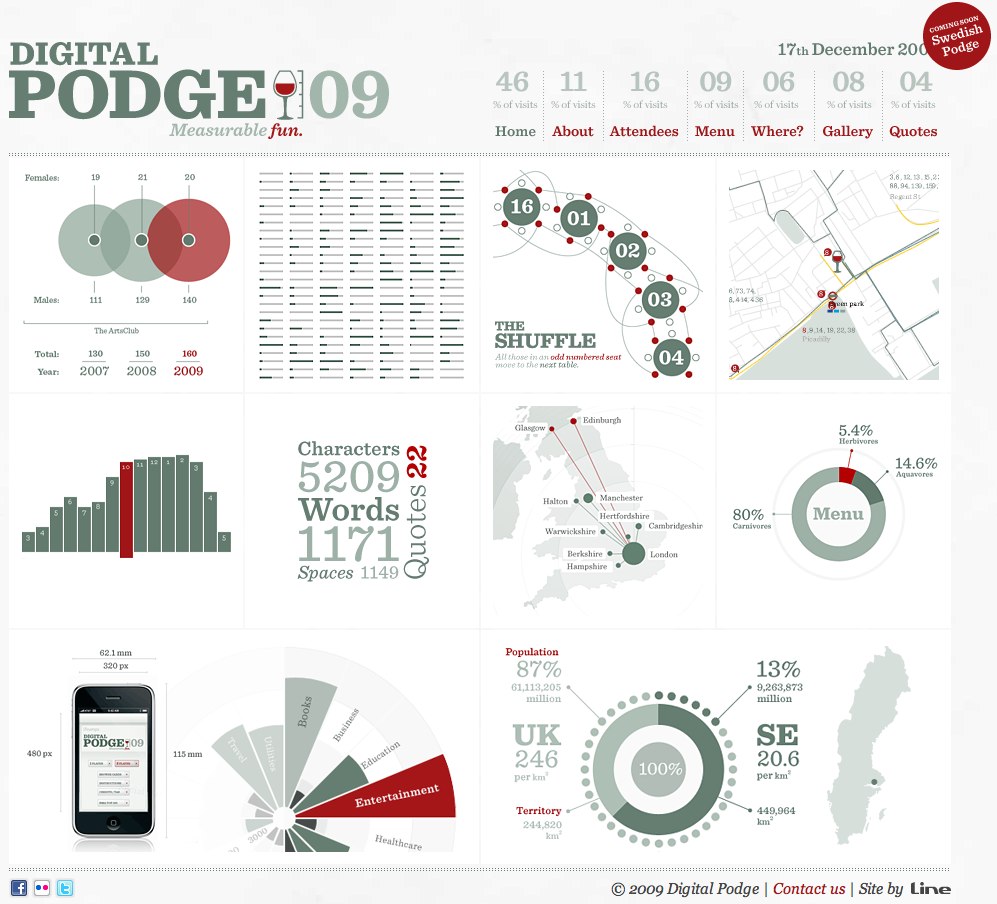
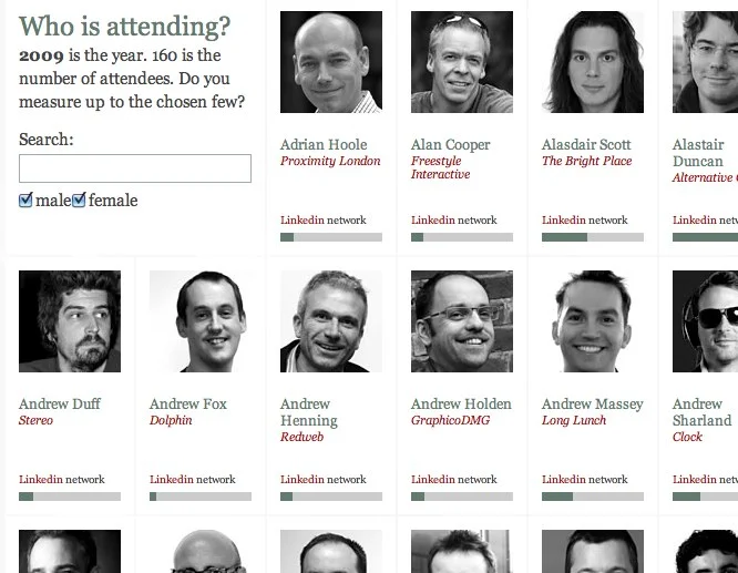
A fantastic, infographic website design for Digital Podge 2009. Digital Podge is an annual, invitation-only lunch in London, UK for only 160 invitees. The 2009 event was held on December 19th, and since the invite list was fixed at 160, a number of the infographics deal with data about the attendees. Each attendee has a bar beneath their photo indicating how many connections they have on LinkedIN.
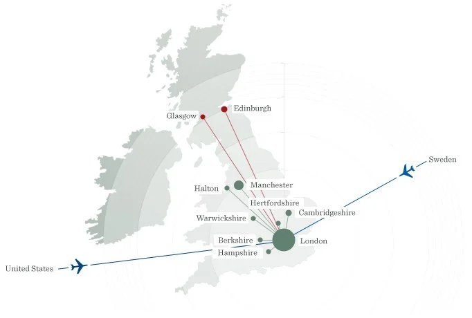
The About page shows a map of where the attendees traveled from to get to the event.
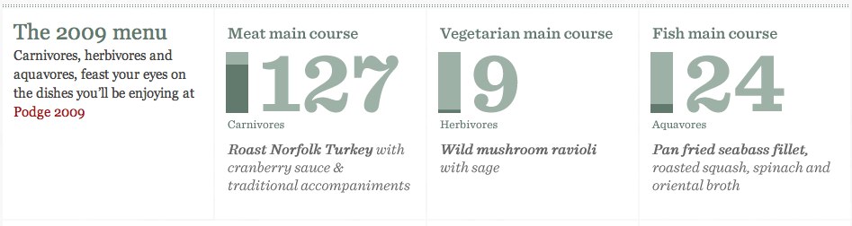
The Menu page show a breakdown of the lunch entree selections made by the attendees.
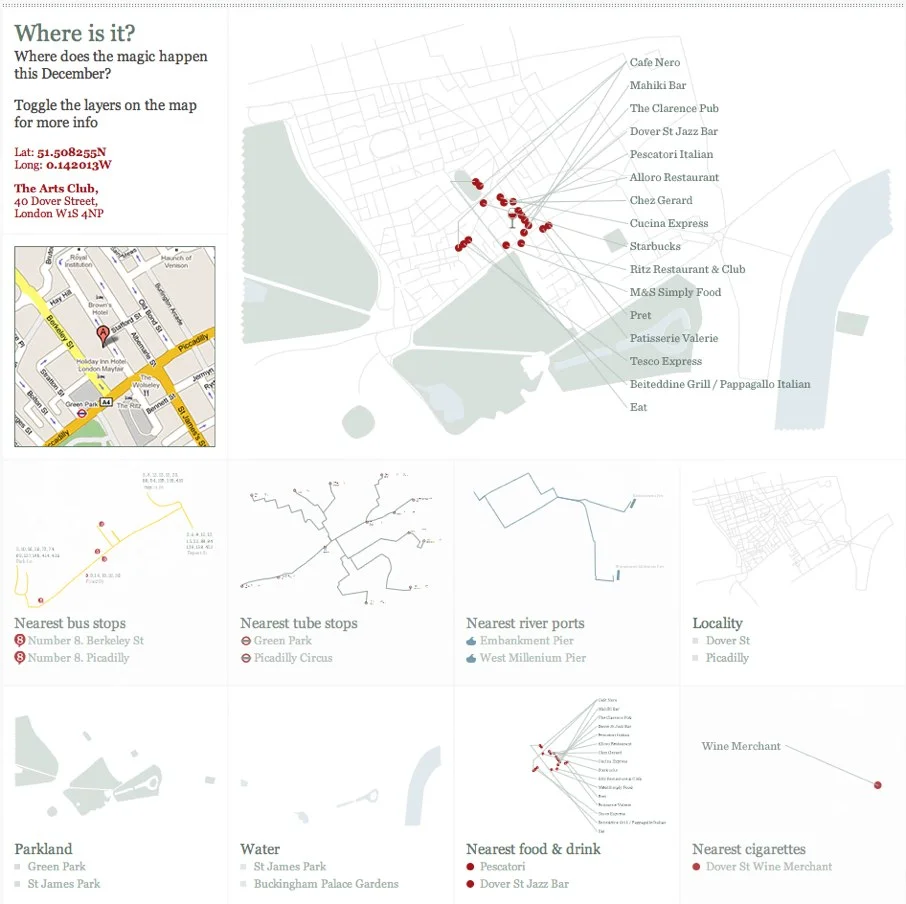
The Where? page is interactive, allowing the user to add or remove layers to the map that can show restaurants, bus stops, subway stations, parks, etc.
Designed by London digital agency Line, the site employs simple infographics with a touch of tongue-in-cheek humor.
“While simply being invited to Digital Podge is a huge honour in itself, being tasked with developing and carry out all the campaign touch points for the event is an exercise that holds the agency up to the scrutiny of its peers like no other project. It’s probably one of the most demanding briefs in the sector, but our team of designers and developers revelled in the opportunity to use data in a humorous and informative manner that highlights some of the plusses and minuses of a cutting edge industry,” said Ross Laurie, Managing Director at Line.


