


The Quickest Route to Washington DC
The Quickest Route to Washington DC is a GIS visualization from @ArterialMapping (also known as MattMDL on reddit)
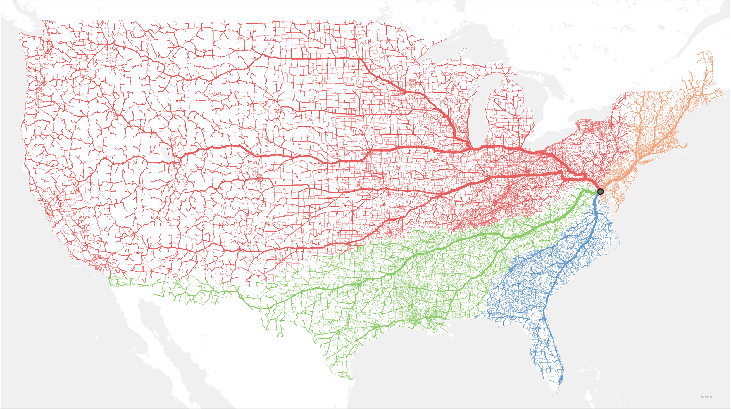
From @ArterialMapping:
How was this map completed? Well, using @Esri ArcGIS Pro Network Analysis toolset! In general terms, there were 4 steps:
1. Created a dot grid for the whole of the continental U.S. This grid is what enables the routes to be created to D.C. A dot was also created for D.C.
2. Run Network Analysis to find the shortest route to D.C. from each dot.
3. Run a calculation for the number of overlapping routes (shown as the stronger strokes on the roadways)
4. Then, of the 4 main spokes I saw, I copied them over into their own layers and colored them accordingly.
Red generally follows I-70 to I-270, Green generally follows I-81 to I-66, Blue generally follows I-95 south of D.C., Orange generally follows I-95 north of D.C.


